
In 2014, Chinese conglomerate DongDu International (DDI) announced its plans to invest $3 billion into projects in Nova Scotia. The largest project would be Crystal City, a new town to be developed on marshland outside Halifax. The complex would include residences, skyscrapers, a technology research center, and large-scale replicas of famous world landmarks, such as the Tower of Pisa and the Eiffel Tower. The company also planned a world class film studio within Halifax, with two docked cruise ships to serve as luxury accommodations for film crews.
As of 2022, DDI owned a five story historic building in Halifax, a golf club in the Halifax community of Bayside, and 6500 acres of undeveloped land, including the Crystal City site. Of that 6500 acres, roughly 3000 sit along the shores of Indian Harbour Lake, in the heart of Port Hilford. It was here that DDI planned a luxury resort for wealthy Chinese tourists. That project is now dead.
To say that the St. Mary’s District of Guysborough County, wherein Port Hilford is located, needed this project is an understatement. Once the heart of Nova Scotia’s profitable gold mining industry, the region is under extreme economic distress. From discussions with residents, I’ve learned that young people have been leaving the region in droves for Canada’s large cities or to work the oil tar fields of Alberta. Skilled labor leaves, not to be replaced.
St. Mary’s District’s fishing industry is suffering from a dwindling supply of mackerel, integral to both local trade and for baiting the area’s lobster traps. The two schools in St. Mary’s District’s seat Sherbrooke were recently combined into a single academy due to the dwindling number of students and the baseball field built on the shores of Indian Harbour Lake was razed. There just weren’t enough players.
Into this environment came the Whale Sanctuary Project, not intentionally, but out of desperation.
WSP SHOOTS AND MISSES
WSP advertised its sanctuary to locals as a major tourist attraction. In 2018, it approached Terrence Bay, a half hour drive from Halifax, among many communities where they faced strong opposition from the local fishermen. The potential sites scouted in 2019 were all within a three hour drive of Halifax – Liverpool and Shelbourne to the south and Sheet Harbour and Port Hawkesbury to the east. In each of these towns, WSP again faced opposition from local fishermen.
Finally, WSP was welcomed into the seat of the St. Mary’s District, Sherbrooke, with open arms. With DDI’s project on Indian Harbour Lake dead in the water, government officials began looking at other potential economic catalysts. One involved the reintroduction of gold mining. Another was centered around ecotourism, and into this strategy, which included freshwater canoeing, fly fishing, and hiking, came a proposed whale sanctuary.
Local WSP volunteer Amy Simon took the reins as the organization’s primary contact in the area. WSP recruited both the Executive Director and Operations Director of Sherbrooke Village, a local historical museum and the largest tourism attraction in the area, to help communicate the WSP project with the community and officials. Simon would continue her efforts to ensure WSP maintained a strong presence within the community through the sponsorship of community events.
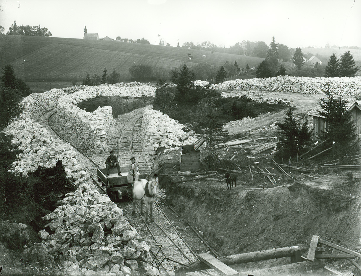
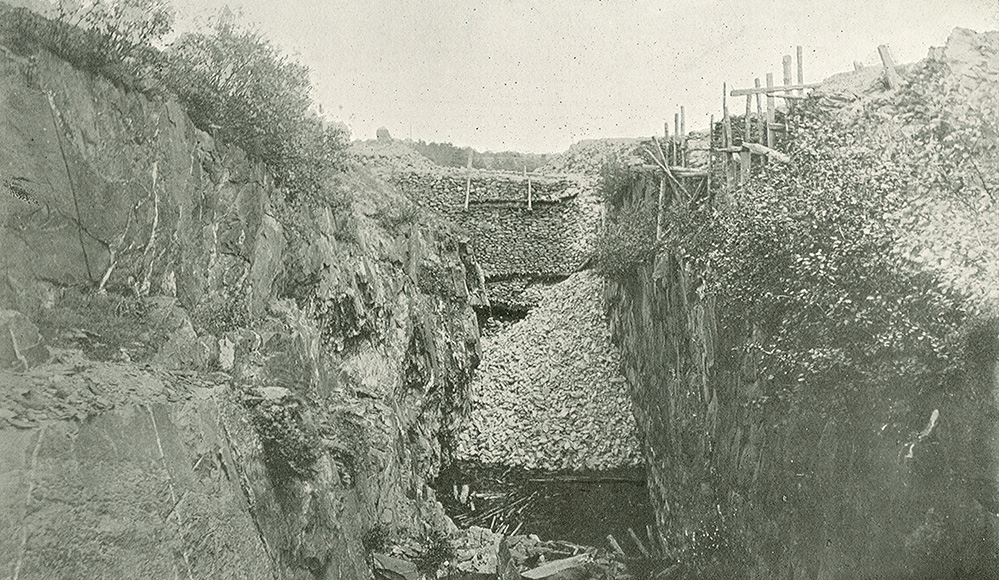
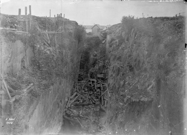
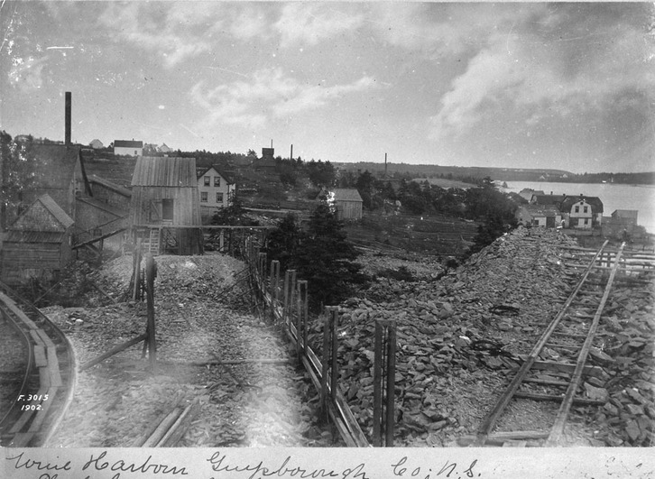
Mining operations near Whale Sanctuary Site. Sources: Nova Scotia Archives and Mindat.org.
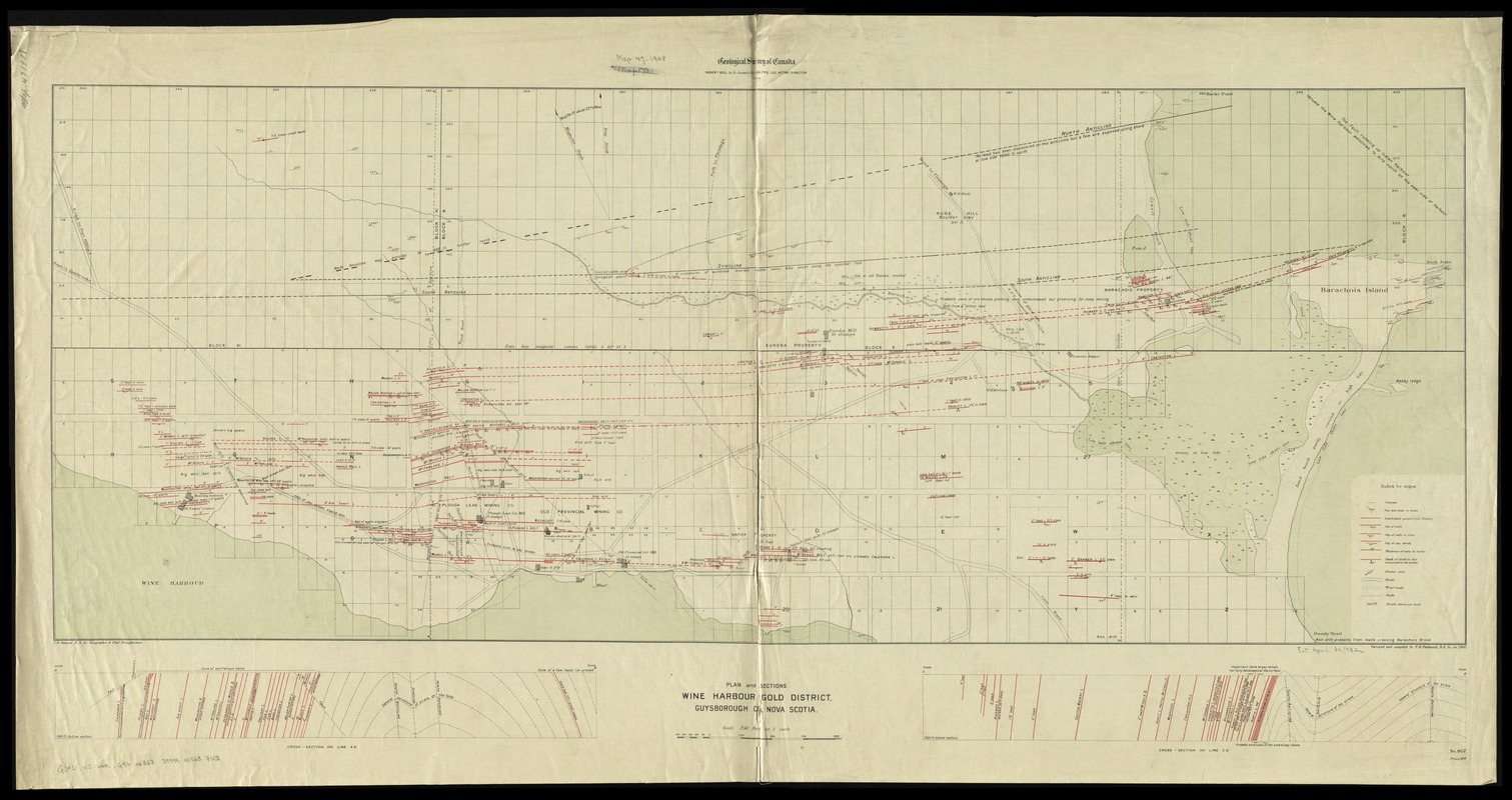
1905 mining map, showing operations across sanctuary site. Source: Boston Public Library
When searching for a site within St. Mary’s District, WSP again came into conflict with fishermen. While mackerel were still a staple of the trade, most fishermen had transitioned to fishing lobster and bivalve shellfish, such as oysters and clams. Then a conflict arose up and down the Nova Scotia coast between the Mi’kmaq First Nation, local fishermen and DFO. The Mi’kmaq believed they have the right, under a Canadian Supreme Court decision, to fish in restricted areas and without limit. This conflict resulted in a series of violent altercations and arrests. As a result, DFO increased the number of enforcement officers at its local offices, including Sherbrooke, to deal with this issue.
Of the three potential sites within St. Mary’s District, the mouth of the St. Mary’s River (not to be confused with St. Mary’s Bay, which is due west of Halifax) is continually traversed by fishing vessels, creating potential acoustic issues for the whales. Much of Wine Harbour is occupied by a permitted oyster farm, reducing the available amount of acreage, and its body of water lacks proper circulation from the ocean. Finally, WSP settled on the third option – the western side of an inlet, with a rocky peninsula at its mouth leading to an island, both of which partially block waves from the ocean. Homes dot the eastern side of this inlet, but the western side is mostly bare. The property included an abandoned fishing dock, complete with a partially submerged rusting car ferry.
The inlet is known as Indian Harbour, inaccurately referred to by WSP as Port Hilford Bay, likely an attempt to not offend the Mi’kmaq, with whom WSP has aligned. WSP first met with this First Nation’s elders in 2017, a year before the first community under consideration in Nova Scotia was approached.
Sometimes there is a fine line that must be straddled in negotiating with different stakeholders. Although an interim agreement was made between DFO and the Mi’kmaq in October 2021 regarding fishing rights, the hostilities between tribal and non-aboriginal fishermen that preceded it “was definitely a factor,” one resident of Sheet Harbour told me. “And it wasn’t in the Whale Sanctuary folk’s favor.”
Regardless of whether it’s referred to as Indian Harbour or Port Hilford Bay, the location is an ecological disaster.
ARSENIC AND OLD WASTE
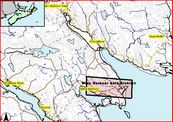
In 2015, members of the Canadian Geological Survey and DFO co-published a paper based on research sponsored by Dalhousie University of Halifax on toxin levels in the Wine Harbour gold district, a historic mining region stretching from the WSP sanctuary site to the east to the adjacent inlet, Wine Harbor, to the west. A number of terrestrial soil samples were taken on the land between the two inlets and marine soil samples were taken within Wine Harbor.
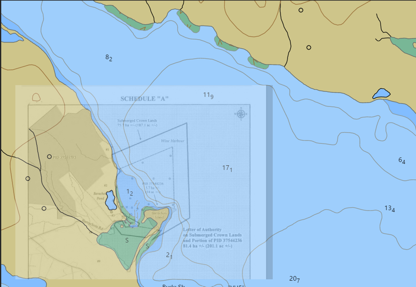
Overlay of inner boundary and outer protective net for proposed Port Hilford whale sanctuary over depth chart for Indian Harbour. Sources: FOI files from Nova Scotia Department of Natural Resources and Renewables/Garman via data from Canadian Hydrographic Service
While no marine soil samples were taken inside Indian Harbour, land soil samples were taken on the proposed WSP site, less than 600 feet from the dock and only a few feet from shore. The analysis of samples from the proposed WSP site, indicated as T1A in the report, show higher than normal levels of elements used in traditional gold mining. Mercury levels were 83 times higher than what’s normal for soil, lead 1.13 times higher, and sulfur 2.8 times higher. Arsenic levels were an astounding 340 times higher. Bivalve shellfish in the region have been ingesting the toxins for decades. In 2017, a no fishing order for bivalves was posted by DFO for all of Wine Harbour. In 2019, a similar order was issued for the entirety of Indian Harbour.
Originally, Indian Harbor stretched 6.2 miles from its mouth on the Atlantic to its farthest tip in the northwest. The area surrounding Indian Harbour is Port Hilford, named for the port that once existed at the spot during the heyday of the region’s gold rush. Port Hilford, as it currently stands, is not a town, but rather a rural community, with homesteads, farms and vacation homes spread over hundreds of acres. During heavy storms, waves as high as ten to fifteen feet can enter Indian Harbour. The eastern section of the whale sanctuary will be exposed to these waves.
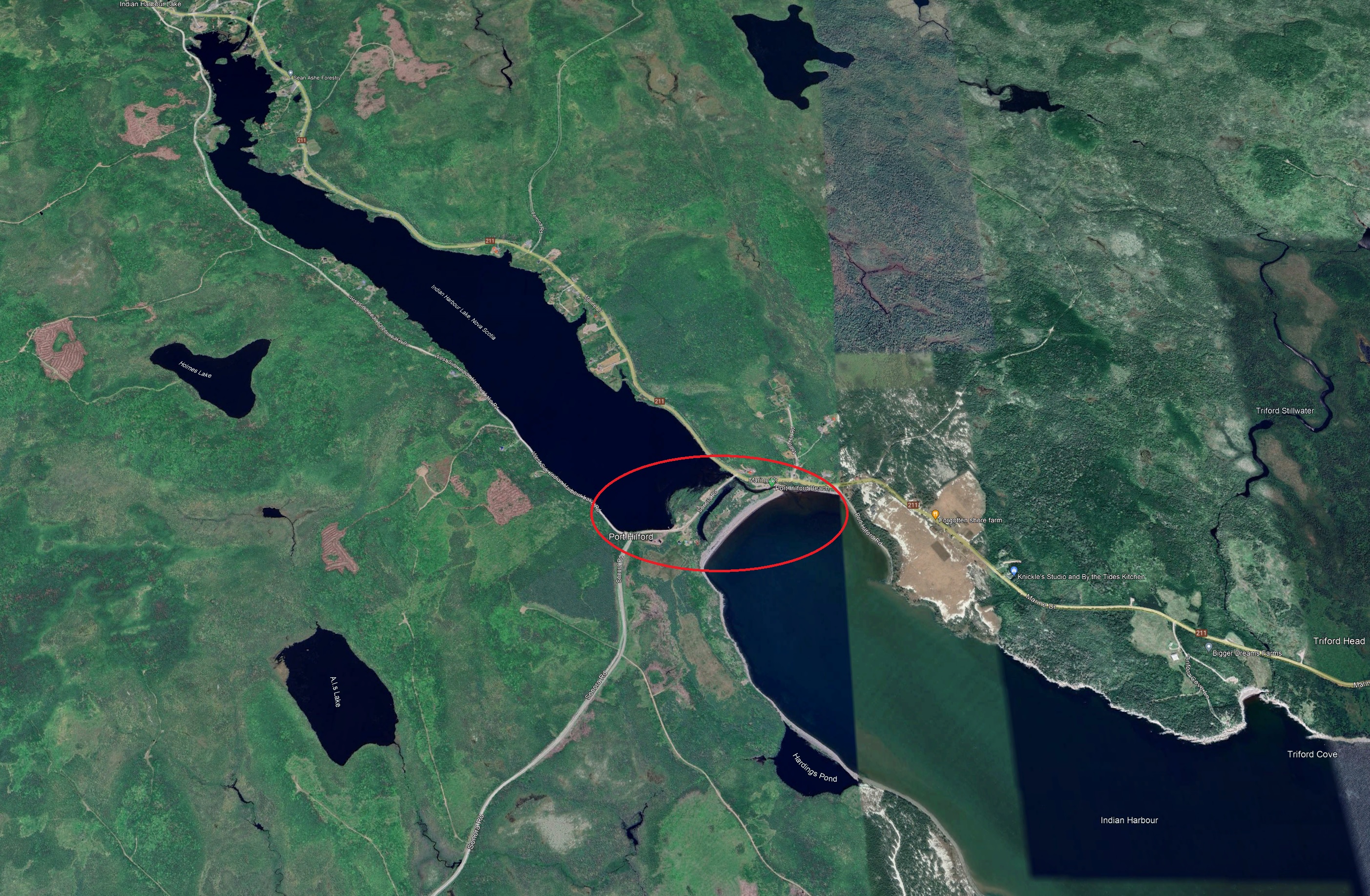
In order to prevent salt water from overtaking the freshwater in the inland part of Indian Harbour, and to prevent storm swells from flooding properties on the more pristine inland section, residents in 1930 constructed a small granite dam splitting the waterway into two – the saltwater Indian Harbour to the southeast and the freshwater Indian Harbour Lake to the northwest. A local tourist destination, Port Hilford Beach was naturally formed from the tide and waves depositing sediment at the foot of the dam. Part of the beach has decayed, however, as water drained into the lake over the years created a channel on the east side of the dam, reconnecting the two bodies of water.
An unfortunate side effect of the dam was the destruction of the native estuary, which in many instances can filter out pollutants. This is to be expected. Conservation and ecological preservation have been secondary goals within the St. Mary’s District for decades, as seen by the lack of care to clean up industrial waste in the aftermath of the region’s gold mining days.
TOP IMAGE: Chart showing Indian Harbour Gold District stretching across lower section of sanctuary property. Source: Nova Scotia Department of Natural Resources and Renewables


One thought on “So Long, and Thanks for All the Fish: A Whale Sanctuary Project adventure”